In the town of Mogpog, north of Balanacan Port can be found the Luzon Datum of 1911, a stone atop a hill which was designated by the United States Coast and Geodetic Survey (USCGS) in 1906 as the main geodetic station for triangulation network of the Philippines, and then further designated in 1911 as the datum origin of the Luzon Datum which became the basis of all the calculations of exact latitude and longitude of the positions of all places in the Philippines. In effect, it was recognized as the exact center of the whole Philippine Archipelago.
 |
| The single stone marking the very center of the Philippines Picture credit to Galaero Escape Travels |
Upon embarking on a trip to the island of Marinduque with a very beautiful lady, April, I already planned to visit the Luzon datum landmark thinking that not visiting it is tantamount to not really being able to visit the center of the Philippines. As I have already been to the northernmost (Batanes) and southernmost (Tawi-tawi) Philippine provinces, I would not let go of the chance to also be able to visit the very center of the Philippines.
From Mogpog Town, we rode a tricycle to Balanacan Port where we plan to hire habal-habal going to Barangay Hinangayon where Luzon Datum can be found. Along the way, I asked the driver how to go to Luzon Datum and he offered his service for Php 400.00, round trip. I readily accepted. All along, I thought that the tricycle will bring us right at the stairs going up Luzon Datum but I soon learn of the reality: before being able to reach the stairs with 300 or more steps going to the famed stone, we would have to trek for more than an hour from the jump-off point.
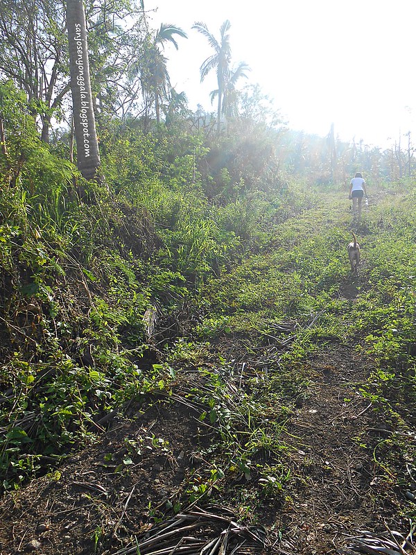
It would be an understatement to say that the trek was really tiring and adventure-filled what with our tricycle not being able to reach the jump-off point because of being stuck in the sticky mud making our trek longer; being unable to notice the stairs we should be taking up the datum making us spend more time trekking the wrong direction; hiking large boulders which brought us to nowhere but a possible meet-up place for different snake species and thorny bushes and tall grasses; and worst of all, hiking with no water to quench our thirst.
In the end, we retraced our steps and go back the way we went and voila - we finally located the stairs we were looking for!
Upon reaching the top of the stairs, I was overwhelmed by my tiredness and thirst that I readily lie down in the gazebo beside the datum marker and rest there for some minutes. After regaining some of my strength, I began to take in the beauty of the views from the datum. The beautiful scenery lifted my strength more and I realized that the hard trek that we have done was actually rewarded.
And I finally realized - this is it! I finally reached the center of the Philippines! The "very center" of the Philippines at that (at least according to NAMRIA, the Philippines' foremost agency in national mapping).
In the same place where the datum stone is located can be found a newly-installed historical marker heralding the stone's significant place in the Philippines history of cartography, geography and geodetic engineering.
From Mogpog Town, we rode a tricycle to Balanacan Port where we plan to hire habal-habal going to Barangay Hinangayon where Luzon Datum can be found. Along the way, I asked the driver how to go to Luzon Datum and he offered his service for Php 400.00, round trip. I readily accepted. All along, I thought that the tricycle will bring us right at the stairs going up Luzon Datum but I soon learn of the reality: before being able to reach the stairs with 300 or more steps going to the famed stone, we would have to trek for more than an hour from the jump-off point.
It would be an understatement to say that the trek was really tiring and adventure-filled what with our tricycle not being able to reach the jump-off point because of being stuck in the sticky mud making our trek longer; being unable to notice the stairs we should be taking up the datum making us spend more time trekking the wrong direction; hiking large boulders which brought us to nowhere but a possible meet-up place for different snake species and thorny bushes and tall grasses; and worst of all, hiking with no water to quench our thirst.
In the end, we retraced our steps and go back the way we went and voila - we finally located the stairs we were looking for!
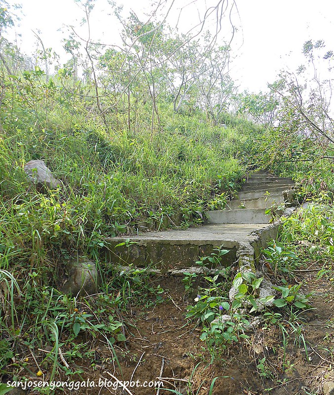 |
| The ever elusive flight of stairs going up the Luzon Datum of 1911 |
Upon reaching the top of the stairs, I was overwhelmed by my tiredness and thirst that I readily lie down in the gazebo beside the datum marker and rest there for some minutes. After regaining some of my strength, I began to take in the beauty of the views from the datum. The beautiful scenery lifted my strength more and I realized that the hard trek that we have done was actually rewarded.
 |
| San Andeas Islands viewed from Luzon Datum |
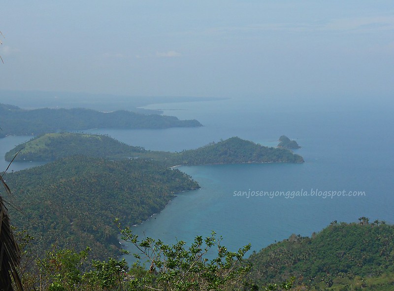 |
| Marinduque's version of Sleeping Dinosaur |
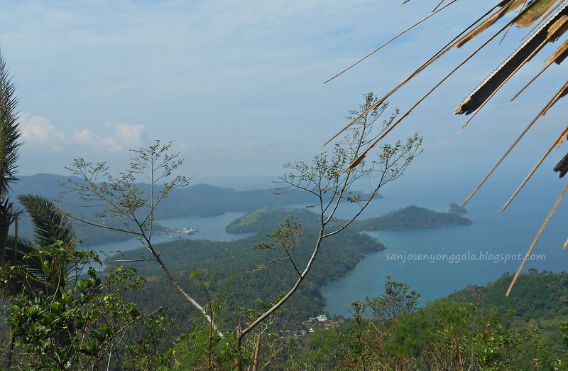 |
| Mogpog Cove. Mogpog port can be seen from a distance. |
In the same place where the datum stone is located can be found a newly-installed historical marker heralding the stone's significant place in the Philippines history of cartography, geography and geodetic engineering.
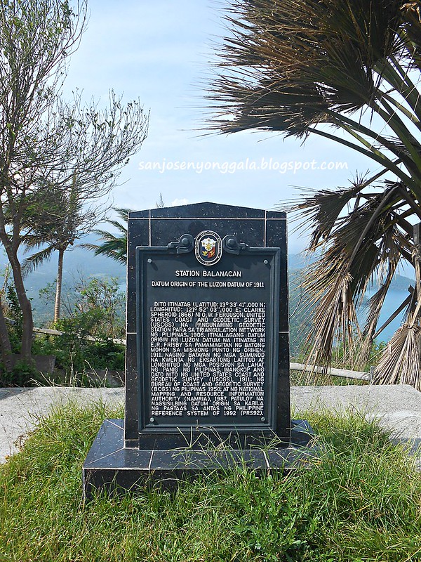 |
| Historical Marker of Station Balanacan. Datum Origin of the Luzon Datum of 1911. |


Naks! Congrats bro! Nakarating ka rin sa hometown ko. Marami pang pedeng puntahan jan if you longer stay sana. Anyway, good write up!
ReplyDeleteI love Philippines.. ang layo na nalakbay ng iyong mga mata bestmel
ReplyDelete